8 years later, Red Dead Redemption 2 players are trying to figure out how ships from the Saint Denis port reach the sea

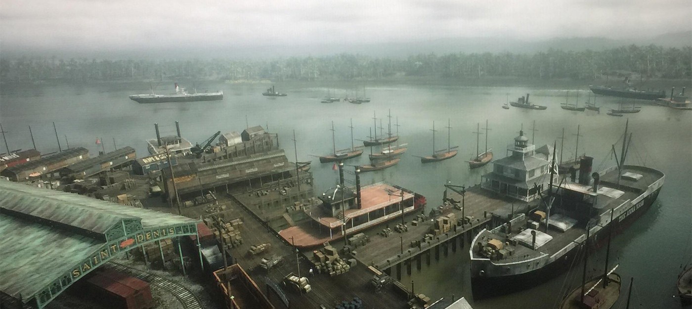
The biggest city in Red Dead Redemption 2 sits on fresh water, and the only route downstream ends at a waterfall. A map breakdown recently made the rounds in the community – almost eight years after the game released.
It's not the first time someone has pointed out this detail, but this time it caught a lot of attention. The question is simple: how does Saint Denis function as a major port at all?
The game geography is genuinely landlocked. The city sits on the Lannahechee River, which connects with Flat Iron Lake to form one freshwater system, and the current flows west toward the San Luis River. Near the New Austin border, the river drops off at a waterfall, while upstream it traces back to a source in the northeastern mountains.
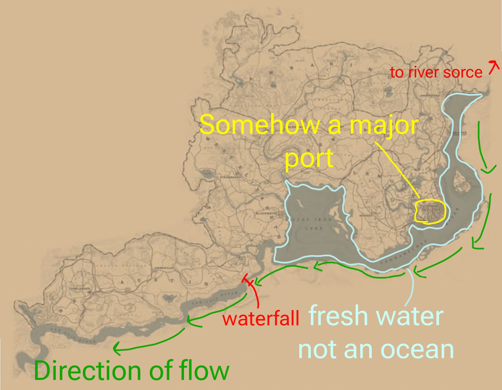
The story contradicts this closed-off setup directly. In chapter five, the Van der Linde gang boards a ship at the Saint Denis port and ends up shipwrecked near Guarma, a tropical island with sugar plantations. That means an open-sea route exists somewhere – it just isn't shown on the map for some reason.
Saint Denis was modeled after New Orleans, and a river-based port isn't inherently a mistake. The real New Orleans doesn't sit right on the coast either – it's about 100 miles up the Mississippi – and that never stopped it from becoming the country's biggest trade hub by the end of the 19th century.
River and lake ports located inland remain a working setup even today:
New Orleans, roughly 100 miles up the Mississippi from the Gulf of Mexico
Portland, Oregon, about 100 miles up the Columbia River from the Pacific
Lewiston, Idaho, roughly 465 miles inland from the ocean
St. Louis, Memphis, and Vicksburg along the Mississippi
Great Lakes ports connected to the Atlantic through the St. Lawrence River system
The comparison falls apart on one detail, though. None of those harbors are cut off from the sea by a vertical drop, and upstream shipping works precisely because there's no physical barrier in the way.
The in-game waterfall between Flat Iron Lake and the San Luis River makes the route impassable in either direction, unless there's a lock system nobody's ever seen.
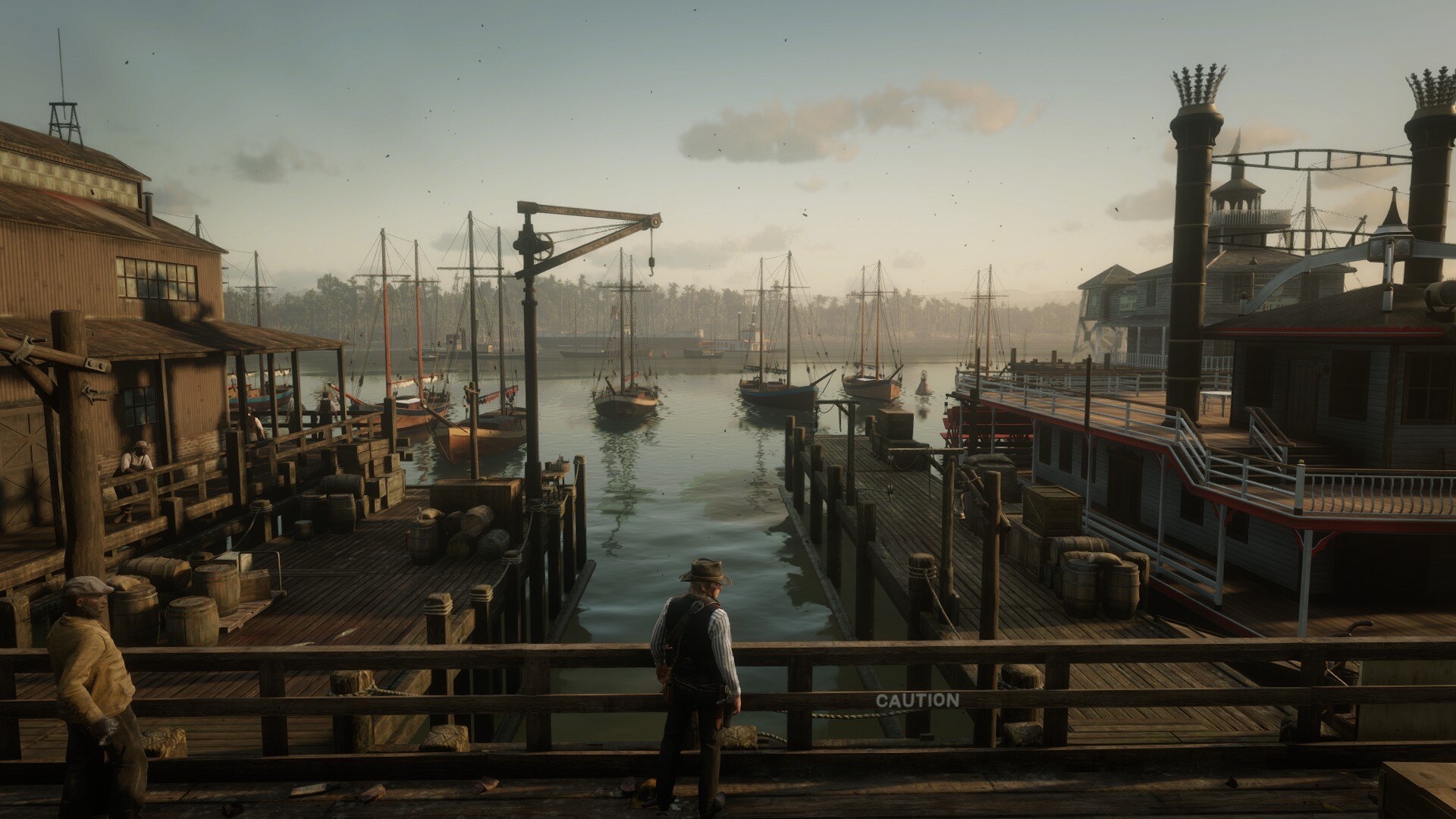
The most obvious explanation comes down to scale. The map compresses several states worth of territory into something a rider can cross in an hour, and the strip of land south of Saint Denis mostly exists to sell the illusion of a world that keeps going. Flat Iron Lake basically stands in for the Gulf of Mexico, with the far shore acting as set dressing.
The original game adds another constraint. Flat Iron Lake was already a lake in the 2010 Red Dead Redemption, so turning it into a bay would have meant rewriting the geography of the first game. Rockstar chose to keep continuity instead.
The city name itself has a history of edits. On a leaked 2016 map and in some in-game textures, it's still labeled New Bordeaux, and the name got changed after Mafia III from 2K – another studio under Take-Two – used that name first. The final name references Saint Denis, a third-century Parisian bishop who, according to legend, picked up his own severed head after being decapitated and walked several miles carrying it.